 |
|
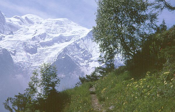
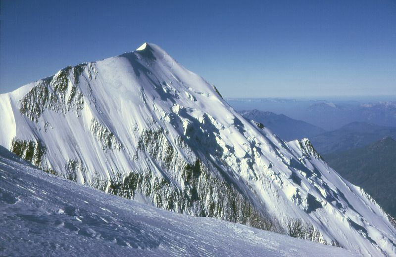
Mont Blanc viewed from the opposite side of
the Chamonix valley.
|
After the successive disappointments on Mont Blanc and Monte Rosa the previous year, there could be no doubt about what the target in 1974 would be. I wanted to finish what I had started on Mont Blanc.
As usual, I had been building stamina during the spring through running exercises (a 5-km loop; always bearing in mind the advice of a Finnish olympic champion: "If you do not feel the taste of blood in your mouth after 400 m, you are being too lenient on yourself."). But I also needed to get acclimatized to the extreme (to a European) altitude of Mont Blanc. At its summit, the air pressure would be just over half of what it is at sea level.
For my "acclimatization camp" in July, I selected the small French-speaking mountain village of Arolla in Val d'Hérens, a side valley of the main Rhône valley in Valais in Switzerland. (Link to map.) Arolla sits at an altitude of 2000 m. Unlike the neighboring valley that leads up to Zermatt, it certainly was "the road less travelled by". No Japanese or American tourists, just Swiss vacationers and some French visitors who enjoyed the unspoiled landscape. The flip side of this was that the mountain paths were poorly marked and signposts were rare. This has probably changed for the better now, but I took several wrong turns during my excursions.
|
|
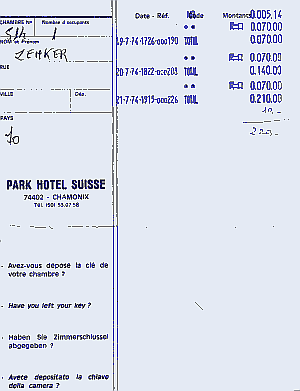
I continued down the Rhône valley to Martigny and then crossed the Col de Forclaz pass to Chamonix. There, I found a hotel room and walked over to the Bureau de Guides. My guide from the previous year was unavailable for the following day, but I was assigned another experienced and pleasant guide (whose name escapes me). The weather was excellent, so we agreed to start our expedition the following day.
|
|
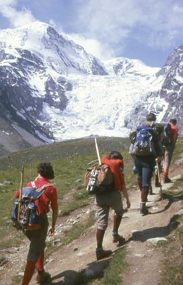
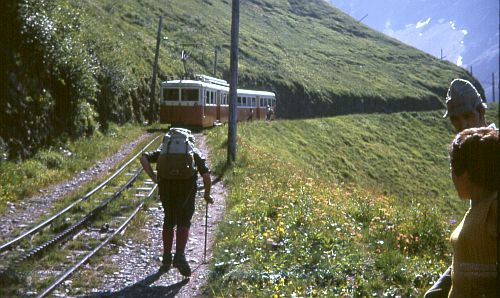
The next morning, we followed "the same procedure as last year" (see previous section). I picked up my guide and drove down the valley to St. Gervais where the small narrow-gauge cogwheel train carried us up to the Nid d'Aigle (Eagle's nest) at 2300 m. From there we walked to the Tête Rousse hut, enjoyed lunch and continued to the Goûter hut at 3800 m.
 |
 |
|
We reached the Goûter hut late in the afternoon and enjoyed supper and a relaxed evening there. My guide complimented me: "Monsieur est promeneur!" The weather was excellent.
|
|

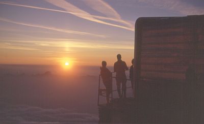
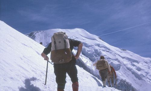
A pre-dawn wake-up, a hurried breakfast and it was time to get underway. There was no moon that night, and I have never seen the stars shine as brightly before or since. No city lights, plenty of time for dark adaptation, and just thin dry air above.
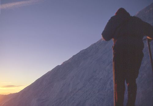
In contrast to the previous day, with its easy rock scramble, there was only a long walk ahead up the slopes. The pace was comfortable. Gradually dawn started to break, and the magnificent starry sky began to turn pale. There were few landmarks along the way and progress seemed rather slow, especially on the steeper slopes.
Gradually, I started to get short of breath, and we had to make short pauses. I started to count the number of steps, promising myself that I would not ask for another pause until I had reached one hundred. Gradually I was forced to reduce my target to fifty, then to twenty. I was feeling dizzy. My guide encouraged me to breathe deeply and regularly.
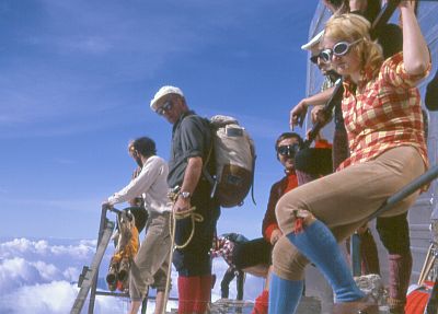
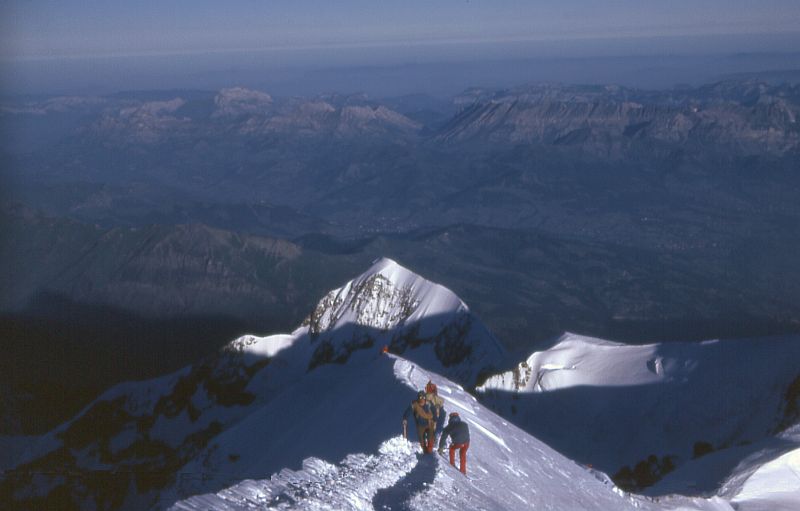
I am sure that we would have had to turn back if we had not been so close to the summit. The slope became gentler and gradually flattened out. Suddenly, unexpectedly, my guide turned around and informed me that we had arrived. And in fact, looking around I could see that, although we were standing on a rather wide horizontal surface, there was no higher point to be seen around us.
I breathed a deep sigh of relief, or more accurately, I was sobbing for a moment. We shook hands while he gave me a penetrating look. I gave a fleeting thought to the amazing fact, that out of all the many hundreds of millions of people in Europe, I was literally the highest placed at that moment (feet on the ground).
 |
 |
|
|
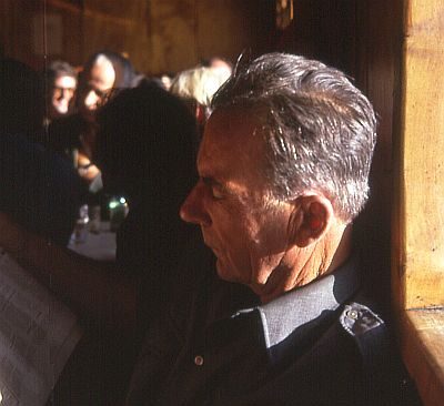
Me and my guide on the summit of Mont Blanc,
July 20, 1974.
|
||
We did not stay long. The temperature was around minus 15 C. As we started our descent, we constantly encountered groups of climbers still on their way up.
 |
 |
On the way down we made a brief stop at the Vallot hut nearly 500 m below the summit of Mont Blanc. The Vallot hut is intended as a shelter for mountaineers in distress and is not to be used as a regular staging point, much as the Solvay hut on the Matterhorn. There my guide offered me a strong drink, hoping to revive my flagging strength, but it just caused me to vomit. Despite, or rather because of, my nausea, we continued towards the Goûter hut as quickly as possible.
 |
|
|
|
 |
|
|
Aiguille de Bionassay
|

 |
|
Copyright:
AGEP Marseille
|
|
Once we arrived at the hut, I enjoyed a much-needed hour of rest. I overheard the guardian tell people that he had recently been forced to call a helicopter to evacuate a climber who had succumbed to mountain sickness. This gave me all the incentive I needed to continue our descent, although I still felt a bit "woozy".
The farther we descended, the better I felt. Finally, we reached a cable car station and I enjoyed the luxury of streching out on a patch of grass while waiting. Once down in Chamonix, I felt fine and my difficulties were already receding in my memory. But my guide confided that he would have turned back if I had not been going so strongly the first day.
I spent the night in Chamonix. The next morning, after checking out from the hotel, I was still undecided where I wanted to go - down the valley or back to Switzerland. When I reached the main street, the matter was decided by the strong flow of traffic going up-valley. I did not have the patience to wait for a gap in the flow, so I turned right which meant going down the valley. I then travelled to Val d'Isère and on to northern Italy.
At the border I got the usual suspicious look from the customs people (a young man travelling alone is always suspicious), but when they discovered my climbing boots and I stammered "Monte Bianco yesterday", they became very friendly.
My trip took me to Torino, Milano, Como, Bolzano, the Brenner pass to Austria where I visited Innsbruck, Kitzbühel, Heiligenblut and on to Pörtschach on the Wörther See. I spent a few days at the beach there, then went on to Vienna and the imperial castle Schönbrunn. From there I returned to the Alps: I went to Zermatt to see if it would be possible to climb Monte Rosa or the Weisshorn. But the weather was bad, and the forecast equally bad, so I decided to start the long trip home, visiting Paris along the way. Paris is where I subsequently had second thoughts about going home...